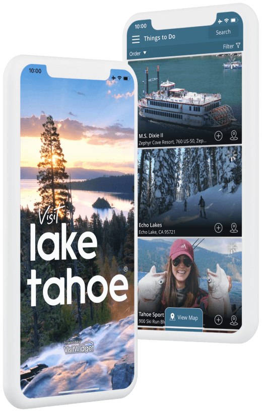
Hiking
This Location:
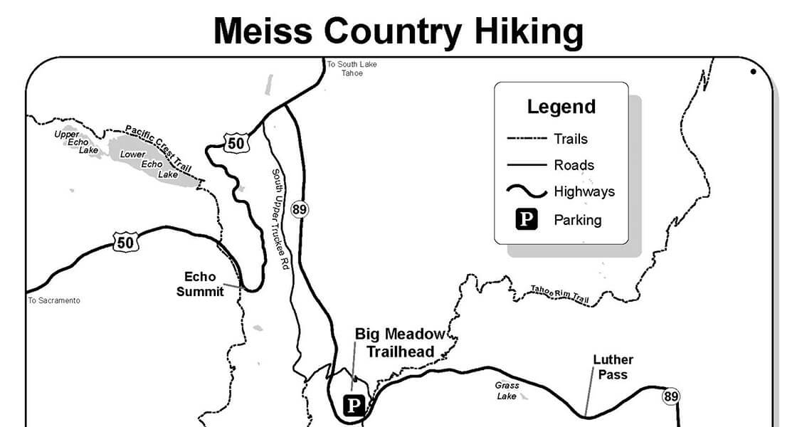
Click here for information on several trails located in Meiss (pronounced “Mice”) Country, located between Luther Pass (Highway 89) and Carson Pass (Highway 88).
Information regarding distance and difficulty is provided, as well as an orientation map. A topographic map and compass are recommended. Weather conditions can change rapidly.
Be prepared with the proper clothing and equipment. Always carry extra water. Hiking permits are not required for Meiss Country.
Campfires are not allowed, camp stoves are permitted with a California campfire permits which may be obtained online and in person from any Forest Service office or fire station.
Hikers, mountain bikes and horses are allowed on all trails in Meiss Country, however, mountain bikes are not allowed on the Pacific Crest Trail (PCT). Parking for horse trailers is available at both trail heads.
Remember, trails are enjoyed by many different types of users. Please show respect.
Big Meadows to Round Lake
Moderate 2.7 miles one way. Take Hwy 50 west to Hwy 89, 4 miles to the Big Meadows parking lot on the left. Follow the trail at the lower end of the parking lot approximately 200 yards, where it intersects with the highway. Look for the trailhead sign across Hwy 89.The first 1/2 mile of this trail climbs from the highway through Jeffrey pine and white fir to Big Meadow. After crossing the creek and a large meadow, the trail enters the cover of a lodgepole forest. In another 1-1/2 miles, the trail descends nearly 250 feet along an aspen-covered bank to a junction. Take the left fork which leads by a wall of volcanic rock. After another short climb up a small hill, the trail leads to Round Lake.
Big Meadows to Scotts Lake
Easy 2.5 miles one way. Follow directions to Round and Dardanelles Lake until you reach the Scotts Lake trail junction approximately 1/4 mile after the trail begins. Here the trail climbs upward at a gradual pace through Jeffrey pine, and fir, high above Big Meadow. A great hike in the fall, the trail travels through a beautiful aspen grove which opens into a valley covered with juniper and sagebrush. A short distance further, the trail turns into a jeep road, leading to Scotts Lake.
Big Meadows to Dardanelles Lake
Aspen trees and wildflowers along the trail make this an exceptionally scenic hike during the spring and fall. Follow directions from the previous hike to the trailhead. When the trail forks approximately 1-1/2 miles past Big Meadow, take the right fork. In less than a 1/4 mile, take the unmarked trail to your left which crosses the creek. The trail winds through willows before crossing two more streams. A short climb leads you to Dardanelles Lake, surrounded by picturesque granite cliffs on one side and flat granite shelves on the other.
Carson Pass to Showers Lake
Moderate 5.1 miles one way. Take Hwy 89 to Hwy 88, turn right at junction. Drive 8 miles to Carson Pass. (There is a fee to park.) Follow the Pacific Crest Trail north through expansive meadows with views of Round Top (10,381′), Elephant’s Back (9,585′) and Red Lake Peak (10,063′).The trail begins by winding upward through a series of switchbacks for a mile. After reaching a summit, the trail drops down a into Meiss Meadows. When you reach a junction, take the left fork which will eventually lead you up a moderate hill, covered with wildflowers in the spring. Reaching the crest, the trail descends to Showers Lake, one of the most beautiful lakes in the Tahoe area.
Hwy 88 to Meiss Lake
Moderate 4 miles one way. Follow directions from the previous hike to Carson Pass. Park on the north side of Carson Pass. (There is a fee to park). Follow the trail up a hillside covered with mules ears and sagebrush to a saddle, providing views of the surrounding peaks. At this point the trail follows an old jeep route, crosses the Upper Truckee River and leads into a large meadow. Follow the path to the right .6 miles down the gentle slopes to Meiss Lake. A shallow but scenic lake, Meiss is one of the warmest lakes in the Tahoe area, making it a great place for chest deep swimming. Fishing is not allowed in Meiss Lake.
PCT from Hwy 88 to Hwy 50
A challenging 13 mile one way trip, great views of the Upper Truckee River Basin and Lake Tahoe reward the serious hiker. Two cars are needed for a day hike. Plan to leave one car in the Carson Pass area and one at Echo Summit located on Highway 50. Follow directions from the previous hike to Showers Lake. The Pacific Crest Trail continues across the lake’s only outlet at the north end and then begins a steep ascent past an impressive, overhanging volcanic point. Gradually curving northward, the trail crosses numerous creeks, traverses large meadows and follows forested crests with many ascents and descents. The trail eventually leads to the Echo Summit.
Hiking Meiss Country
South Lake Tahoe, CA 96150